Barry (my father-in-law) and I woke at 3:30 AM to pack our gear. We were joined by Julia and left Sonora at 4:00. Sadly, on the backroads between Tuolumne Rd. and HW 120, Barry accidentally hit a coyote that darted in front of the car. Later, a mile away from the trailhead, we passed a black bear in the gloaming light.

Pic. 1: Half Dome as seen from Glacier Point.
We started at Glacier Point (elevation 7214 ft.) at 6:15 AM and hiked down the Panorama trail over the Illilouette Fall (5816 ft.) and Illilouette Peak to the John Muir Trail, which passes over the top of to Nevada Fall. There, we stopped to eat a quick breakfast of dried cheese, crackers, nuts and fruit before continuing. After breakfast, we plodded up the John Muir Trail, past Liberty Cap and into Little Yosemite Valley, where it met Half Dome Trail.
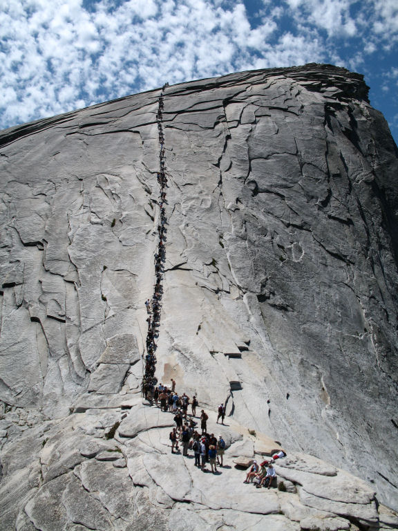
Pic 2. The cables at the foot of Half Dome’s granite cap.
Then, we made our way up the steep zig-zagging trail to the base of the bare granite cap of Half Dome (8,836 ft.). There, we climbed with the aid of cables up the nearly vertical backside of Half Dome. At approximately 12:30 we arrived at the top, joining fellow hikers and a portly woodchuck.
Barry joked later about how, as he reached the top and he looked around, he was certain that he was the oldest living thing atop the mountain (Barry is approaching 60).

Pic 3. Glacier Point as seen from the top of Half Dome.
After negotiating the steps down Nevada fall, we rested a bit, passed Emerald Pool and Vernal Fall on the aptly named Mist Trail. I elected to jog the last half mile down to the bottom of the trail, where I waited for my companions. Finally, after reaching the valley floor (4,000 ft.), we wibble-wobbled our way from the trailhead to Curry Village (adding another mile to the 16 mile hike), and met Dani and Tracey at 6:15 PM or so.
My feet ached for a week. Barry lost two toe nails. We both agree– it was worth the pain.
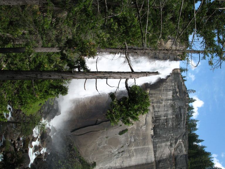
Pic. 4: Nevada Fall at the base of the steps.
You can see our path in its googlemapped glory below.
Map 1: Yosemite Valley– Glacier Point, Half Dome and environs.
